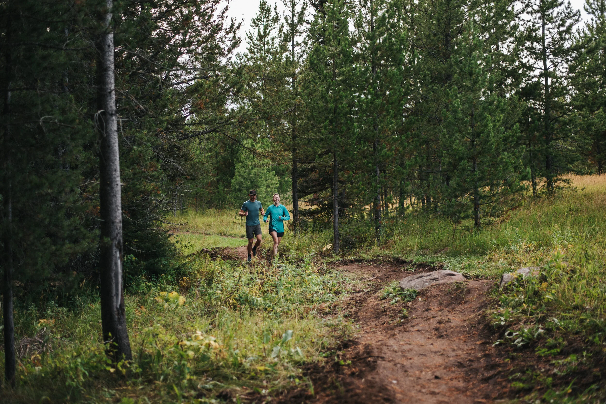
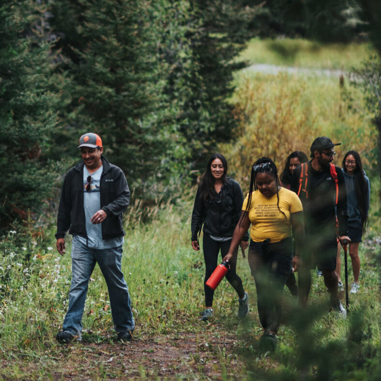
Crosscut’s Summer Trails
Your next hike, trail run, or ride awaits
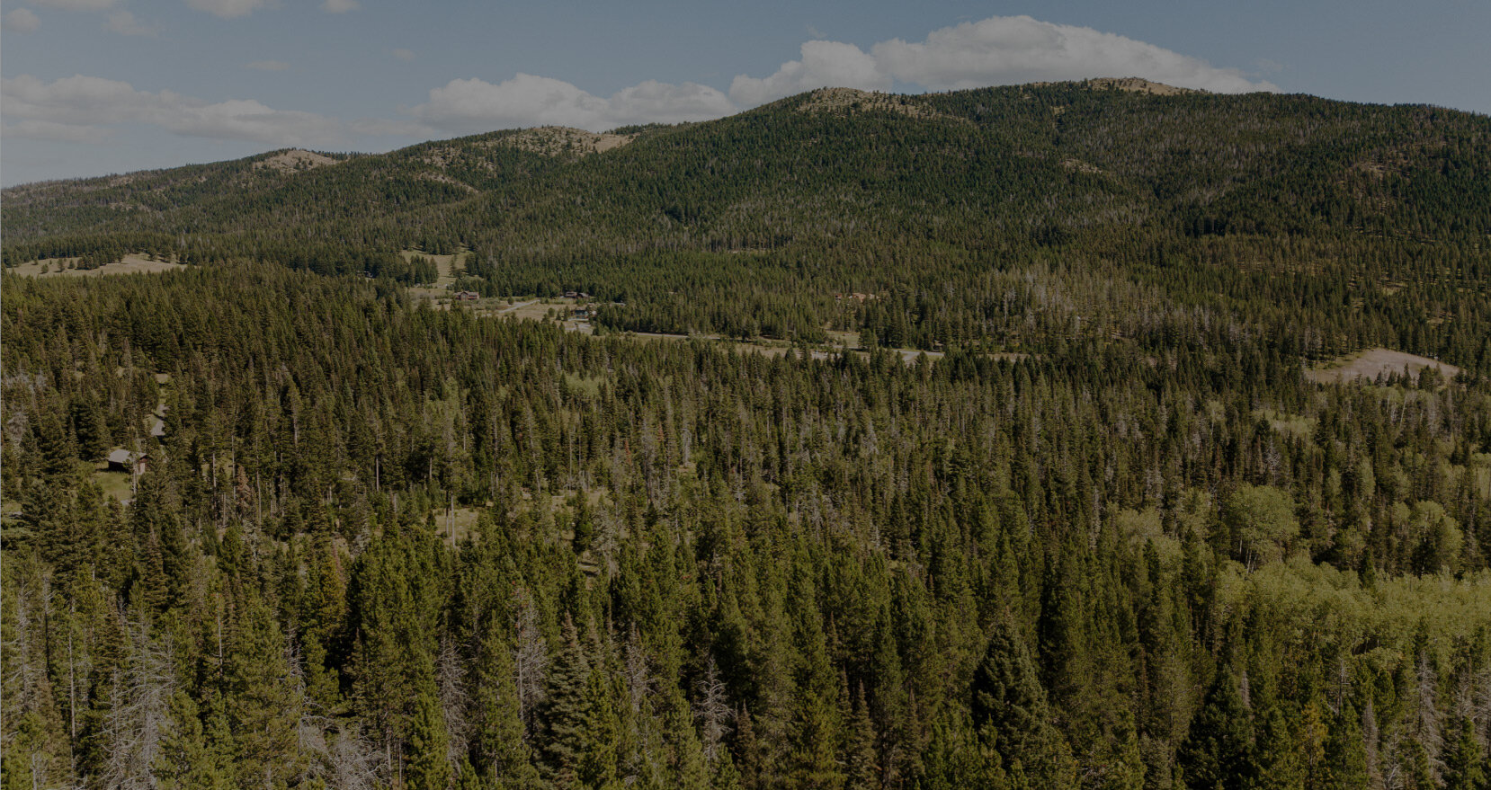
Our summer trail system consists of 21 miles of single-track trail, and our cross-country ski trails offer great hiking and add many more miles of enjoyment and exploration to our summer trail system. The rolling topography of Crosscut's trails offer fun summer adventures for hikers, runners, and bike riders of all ages and abilities. If you are are looking for a longer adventure, Crosscut property borders adjacent trails in the Custer Gallatin National Forest — be sure to plan your own route finding.
You can find our summer single-track trails on the Trailforks smart phone app. We also have summer trail maps at key junctions and mountain bike trail signs on the property.
Summer trail access information
Public trail use is from sunrise to sunset
Our summer trails are free to access — we ask those that can to consider investing in a voluntary summer trails pass to support our nonprofit’s investment in summer trails, facilities, and operations
Organized groups must have prior permission and a signed group agreement – more info here
Our Nordic & Trails Center is open by appointment only to folks renting mountain bikes
In the event of an emergency, Crosscut does not offer any rescue or support services — you are responsible for your own safety
Please obey all closures — trail and facilities work is frequently done in the summer
Dogs must be under voice or leash control at all times
Dogs are not allowed in the biathlon stadium
Bikes are not allowed on the pavement — the paved trail is for biathlon program rollerskiing only
Please pick up after your dog
Crosscut is not open for disc golf or equestrian activities
Please contact us with any questions or comments — we look forward to seeing you this summer at Crosscut!
Use your smart phone to navigate our single-track mountain bike trails
Navigate Crosscut’s summer trails with confidence on your smartphone using the Trailforks app. As always, we’re here to answer your questions — drop us a line.

Getting here and parking
Crosscut is located 17 miles up Bridger Canyon Road, about 30 minutes from downtown Bozeman.
Check out our Winter Trails page for all the details on our impeccably groomed 45-km-long winter trail system.
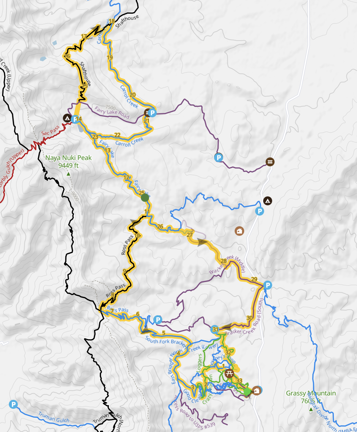
Suggested Summer Trail Routes
Crosscut’s Favorites
Loops and lollipops, what more can you ask for?! Below are six great riding options, with a route for everyone. Whether you are just learning how to ride, towing your kiddos behind you, or are looking for an all day Bridger Range adventure, we’ve got you covered! Each of these routes connect a series of trails to create a special experience. Routes are listed in order of difficulty.
Warming Shelter Loop
Beginner | 3.2km/2.0 miles | 216 ft total climb and total descent | Starts at the Nordic + Trails Center
Trail Forks Link
A beautiful, easy route that circumnavigates the edges of a picturesque meadow in a true loop. Ewok Forest North provides a gradual climb through the trees, before hopping onto Meadow Loop where you will ride along the creek before turning towards the Warming Shelter. Take a slight detour to visit our Skills Park, which features wooden drops, skinnies, a pump track and table top. Meadow Loop will start taking you back down the mountain before turning into Ewok Forest South (stay right at the junction.) Ewok will bring you back to the Nordic + Trails Center with some gradual downhill twists and turns through the trees. This is a perfect ride for beginners or families with little ones!
Map:

Downey’s and Out
Beginner/Intermediate | 5.3km/3.3 miles | 410 ft total climb and total descent | Starts at the Nordic + Trails Center
Trail Forks Link
A great beginner/intermediate friendly after work ride. Enjoy the gradual climb up Ewok Forest North and Meadow Loop before turning right onto Downey’s Loop. This lollipop features fun twists and turns through the trees, and small roots to practice getting over obstacles. You’ll start your descent partway through Downey’s, and then connect back on Whiskey Gulch. Enjoy the final descent on Yoda’s Return, a fan favorite trail which includes flow-y burmed turns and optional stump jumps!
Map:

Crosscut Figure 8
Intermediate | 6.9 km/4.3 miles | 590 ft total climb and total descent | Starts at the Nordic + Trails Center
Trail Forks Link
A great after work loop if you are looking for something quick and fun that will get your sweat on! Cruise up Ewok Forest and Meadow Loop before jumping onto Downey’s. Work on your cornering as you twist and turn through the tree’s, but keep your eyes up and don’t miss your turn for Northwest Passage. Enjoy some fun roller coaster downhills, and listen to the sound of the creek as you pedal up hill a couple of hills. Connecting with Loggers will start directing you back to the Nordic + Trails Center, but not until you climb yourself back to Downey’s. The hard work is done, and now you get to enjoy a smooth downhill, with some stump jumps on Yoda’s Return.
Map:

Flow Trail Loop
Intermediate | 7.4km/4.6 miles | 860 ft total climb and total descent | 1-way trail
Trail Forks Link
Feel the burn then find some turns! The Flow Trail Loop is an intermediate ride that is sure to get your heart pumping and adrenaline flowing. What Goes Up is a one directional trail that weaves and winds you up up up the mountain! Heads up, it gets steeper towards the top of the climb. Take a load off at the top and enjoy in the view of Bridger Bowl above. Remember to buckle your helmet before you start your descent! Enjoy the flow, and practice your cornering on Must Come Down. The fun isn’t over yet! Yoda’s return is a fan favorite featuring bermed turns and a few optional stump jumps!
Map:

Crosscut and Bridger Figure 8
Trail Forks Link
Intermediate | 21.2km/13.2 miles | 2,560 ft total climb and total descent | Starts at the Nordic + Trails Center
A moderate weekend adventure ride! A great 13 mile loop with a mix of steep and moderate climbs and descents. Climb up Ewok Forest North, and hang a left at Jane’s gate in order to jump onto Meadow Loop. Take a left at the first sign for What Goes Up before turning onto Whiskey Gulch, just for a moment, before starting your climb on Upper Biathlon. The climb eases up as you pedal up Loggers, and then jump onto some single track on Good Clean Fun. Your climb continues until about halfway on Bridger North where you’ll begin your first descent connecting back onto Loggers. You’ll take a right on to Northwest Passage and enjoy some rolling terrain through Downey’s (watch for traffic as these are both two directional trails.) Find those climbing legs again, because the fun is just getting started. What Goes Up is a steep, uphill only trail which will lead you into Must Come Down, trust us, the flow trail is worth it. From Must Come Down you will continue your final descent back to the car on Yoda’s Return!
Map:

Bridger Loop from Crosscut
Trail Forks Link
Expert | 53.6km/33.3 miles | 6,250 ft total climb and total descent | Starts at the Nordic + Trails Center
We present to you the Bridger Loop special! Pack a lunch, and maybe even a headlamp! This 33 mile ride comes with over 6,000 feet of climbing. Not for the faint of heart, but sure to be an all day adventure! Ride your way through Crosscut trails before hopping onto surrounding Bridger Range trails. This route connects Bracket Creek, Fairy Lake, Shafthouse, Carrol Creek, Ross Pass, and East Bridger North, before returning back on Crosscut trails. Have fun, and make sure to pack enough water and snacks!
Map: